Податотека:LocationBritishVirginIslands.svg

Големина на овој PNG-преглед на оваа SVG-податотека: 800 × 320 пиксели. Други разделности: 320 × 128 пиксели | 640 × 256 пиксели | 1.024 × 410 пиксели | 1.280 × 512 пиксели | 2.560 × 1.024 пиксели | 1.750 × 700 пиксели.
Изворна податотека (SVG податотека, номинално 1.750 × 700 пиксели, големина: 324 КБ)
| Ова е податотека од Ризницата на Викимедија и може да се користи на други проекти. Подолу е наведена содржината на нејзината описна страница.
|

|
Постои растерска верзија на оваа слика. Треба да се користи наместо векторска слика ако е со подобар квалитет од векторската. File:LocationBritishVirginIslands.svg → File:LocationBritishVirginIslands.png
За повеќе информации за битмапската и векторската графика, прочитајте за промената во SVG. |
Опис
| Опис |
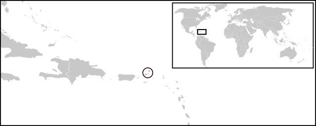
English: Location map for British Virgin Islands. Vectorised version of Image:LocationBritishVirginIslands.png |
| Датум | (UTC) |
| Извор |
Оваа векторска слика е изработена со Inkscape . |
| Автор |
|
Лиценцирање
| Ова е ретуширана слика, што значи дека е дигитално променета (обработена) од изворната верзија. Обработки: Combined two maps to form a newly vectorised version of the British Virgin Islands map. Оригиналот може да се види тука: BlankMap-Caribbean.svg:
|
| Јас, праводржецот на ова дело, го предавам истото во јавна сопственост. Ова важи за целиот свет. Во извесни земји ова не е правно изводливо. Во тој случај: Дозволувам секому да го користи делово за каква било цел, без какви било услови, освен ако такви услови не ги налага законот. |
Изворна евиденција за подигањето
This image is a derivative work of the following images:
- File:BlankMap-World-v2.svg licensed with PD-self
- 2011-03-27T23:08:42Z Wayiran 1243x564 (209452 Bytes) Some correction on North-west border of Iran's map + south of Caspian sea
- 2008-12-03T18:02:36Z Harbin 1326x601 (192122 Bytes)
- 2008-12-02T19:55:14Z Harbin 1326x601 (197882 Bytes)
- 2008-12-02T19:04:59Z Harbin 1326x601 (176022 Bytes) {{Information |Description={{en|1=A blank map of the world as of 2005, with country outlines. Sovereign microstates less than 2 500 km² in area are depicted as circles (see Wikipedia:Image_talk:BlankMap-World-v2.png for list
- File:BlankMap-Caribbean.svg licensed with PD-self
- 2010-09-20T02:01:50Z NuclearVacuum 896x633 (274735 Bytes) new version
- 2010-02-23T15:29:09Z NuclearVacuum 2201x1507 (214283 Bytes) cleanup
- 2010-02-11T19:26:10Z NuclearVacuum 2201x1507 (211807 Bytes) I have started from scratch and made a completely new map of the Caribbean. This current version has an invalid code, but I will work on that later.
- 2009-09-22T00:08:34Z NuclearVacuum 940x477 (252618 Bytes) {{Information |Description={{en|1=Map of the [[:en:Caribbean|Caribbean nations]].}} |Source=[[:File:BlankMap-World6.svg]]{{Inkscape}} |Author=[[User:NuclearVacuum|NuclearVacuum]] |Date=2009-09-21 |Permission= |other_versions=
Uploaded with derivativeFX
Историја на податотеката
Стиснете на датум/време за да ја видите податотеката како изгледала тогаш.
| Датум/време | Минијатура | Димензии | Корисник | Коментар | |
|---|---|---|---|---|---|
| тековна | 04:08, 30 јуни 2011 | 1.750 × 700 (324 КБ) | Maky | {{Bitmap version available|LocationBritishVirginIslands.png}} {{Information |Description={{en|1=Location map for British Virgin Islands.<br> Vectorised version of Image:LocationBritishVirginIslands.png}} |Source=*File:BlankMap-World-v2.svg |
Употреба на податотеката
Податотекава се користи во следнава страница:
Глобална употреба на податотеката
Оваа податотека ја користат и следниве викија:
- Употреба на ceb.wikipedia.org
- Употреба на el.wikipedia.org
- Употреба на en.wikipedia.org
- Употреба на es.wikinews.org
- Употреба на eu.wikipedia.org
- Употреба на fr.wikipedia.org
- Употреба на fr.wiktionary.org
- Употреба на gcr.wikipedia.org
- Употреба на ko.wikipedia.org
- Употреба на pnb.wikipedia.org
- Употреба на ro.wikipedia.org
- Употреба на su.wikipedia.org
- Употреба на sv.wikipedia.org
- Употреба на vi.wikipedia.org
- Употреба на www.wikidata.org