Податотека:Moscow satellite image.jpeg
Големина на овој преглед: 600 × 600 пиксели. Други разделности: 240 × 240 пиксели | 480 × 480 пиксели | 1.000 × 1.000 пиксели.
Изворна податотека (1.000 × 1.000 пиксели, големина: 396 КБ, MIME-тип: image/jpeg)
| Ова е податотека од Ризницата на Викимедија и може да се користи на други проекти. Подолу е наведена содржината на нејзината описна страница.
|
Опис
| Опис |
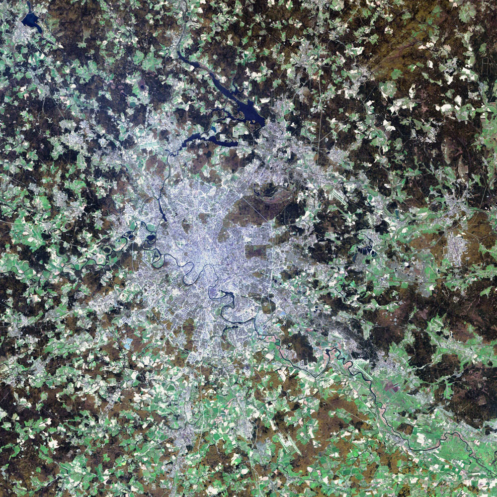
Deutsch: Satellitenbild von de:Moskau English: satellite image of the city of en:Moscow.
|
| Датум | 2 август 2002 |
| Извор | NASA Visible Earth project, http://visibleearth.nasa.gov/view_rec.php?id=3434 |
| Автор | NASA/USGS EROS Data Center Satellite Systems Branch/Landsat 7/ETM+ |
Лиценцирање
Оваа слика е во јавна сопственост бидејќи содржи материјали преземени од Геолошкиот топографски институт на САД, одделение на Министерството за внатрешни работи на САД. За повеќе информации, погледајте ги правилата за авторски права на институтот
|
| Оваа податотека е во јавна сопственост бидејќи нејзин создавач е НАСА. Правилата за авторски права на НАСА велат: „Материјалот на НАСА не е заштитен со авторски права освен ако не е поинаку нагласено“. (Правилата за авторски дела на НАСА или правила за користење на слики од Лабораторијата за реактивен погон (JPL)). | ||
 |
Предупредувања:
|
Историја на податотеката
Стиснете на датум/време за да ја видите податотеката како изгледала тогаш.
| Датум/време | Минијатура | Димензии | Корисник | Коментар | |
|---|---|---|---|---|---|
| тековна | 07:12, 8 ноември 2004 | | 1.000 × 1.000 (396 КБ) | Ævar Arnfjörð Bjarmason |
Употреба на податотеката
Нема страници што ја користат оваа податотека.
Глобална употреба на податотеката
Оваа податотека ја користат и следниве викија:
- Употреба на af.wikipedia.org
- Употреба на ar.wikipedia.org
- Употреба на be-tarask.wikipedia.org
- Употреба на ca.wikipedia.org
- Употреба на hif.wikipedia.org
- Употреба на hr.wikipedia.org
- Употреба на hu.wiktionary.org
- Употреба на it.wikipedia.org
- Употреба на kk.wikipedia.org
- Употреба на lb.wikipedia.org
- Употреба на my.wikipedia.org
- Употреба на roa-tara.wikipedia.org
- Употреба на ru.wikipedia.org
- Употреба на sh.wikipedia.org
- Употреба на sl.wikipedia.org
- Употреба на yi.wikipedia.org